Geographic names
National Land Survey's geographic names are available as interfaces and files. Interfaces and file products comprise of place name products and map name products.
The place name products include data about approximately 800,000 named places and their names in different languages. Data about place are among others place type, plane location and height above sea level, and data about names are among others the spelling that has been checked by the Institute for the Languages of Finland and language (Finnish, Swedish, Northern Sami, Inari Sami or Skolt Sami. In the place name products, every place and its name or names appear only once.
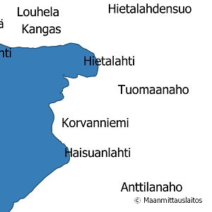
The map name products contain the place names that have been selected for the National Land Survey's nine standard map products and information about the cartographical presentation of them. The information includes the location of the name on the map, for instance the coordinates of the left lower corner of the map text, the direction and bending of the text as well as typographical information, such as font type, size and colour. The name of a particular place, such as a river, can appear several times in the same map product.
The product is a part of the open data of the National Land Survey.

Checked and up-to-date geographic names information serve for instance the accurate communication between authorities and media, geocoding, spatial data systems, map production, map applications and their location searches, national and international standardisation of place names, geographical names planning, research in various fields and all those who need information about what is the correct or recommended way to spell the name of a particular place.
Interface products for Geographic names search service (OGC API Features) are
• Places
• Place names
• Place names, simple
• Map names.
File products containing geographic names are
• Places
• Place names
• Place names, simple (only OGC API Features schema)
• Map names 1:25 000
• Map names 1:50 000
• Map names 1:100 000
• Map names 1:250 000
• Map names 1:500 000
• Map names 1:1 million
• Map names 1:2 million
• Map names 1:4,5 million
• Map names 1:8 million
The contents of the products are equivalent to the interface products and their schema in the Geographic names (OGC API Features) One file always contains the data about the entire country.
https://www.luettelopalvelu.fi/codelist/
The geographic names in Basic map 1:25 000 (Map names 1:25 000). Also available as a GML geographic names element of the Topographic database, see sub-elements of Topographic database (in Finnish):
The geographic names in Topographic map 1:100,000 and 1:250,000 (Map names 1:100,000 and Map Names 1:250,000) and in General map 1:1,000,000 and 1:4,500,000 (Maps names 1:1,000,000 and Map names 1:4,500,000) are also available as a part of the corresponding map series in vector products, see
Maintenance
The data in the product is updated every night.
The dataset in the Geographic names search service (OGC API Features) is updated once a day.
The GML file products according to the Geographic names search service (OGC API Features) in the NLS MapSite Download geospatial data -section are updated three times a year: in January, May, and September.
Quality information
The geographic names products are based on the National Land Survey's Place Name Register and the data checked by the Institute for the Languages of Finland.
Distribution and further information
National Land Survey of Finland
Pricing
Processing fees for Geographic names
| Product | Price € (excl. VAT) | Price € (incl. VAT) |
|---|---|---|
|
7710306791
Processing of Geographic names, EUR per hour
|
106,85 | 134,10 |
