Topographic map (vector)
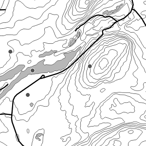
National Land Survey's Topographic map in vector format is a dataset depicting the terrain of all of Finland. The most important elements are the road network, administrative borders, preservation areas, population centres, geographic names, waterways, land use and elevation.
The largest scale level (1:100,000) of the Topographic map in vector format is produced by generalising from the Topographic database. Topographic map 1:250,000 is produced by generalising the dataset 1:100,000. Topographic map 1:1,000,000 is produced by generalising the dataset 1:250,000. Topographic map 1:4,500,000 is produced by generalising the dataset 1:1,000,000. The geographic names have been generalised from the geographic names in the Geographic Names Register to map names suited to the scale in question. The administrative borders in the Municipal Division of each scale are used as administrative borders.
The product belongs to the open data of the National Land Survey of Finland.
Purpose:
The Topographic map in vector format can be used for the production of other map products, e.g. approach maps or maps on a regional or national level.
Geographic location
Entire Finland
Reference system
ETRS89 / TM35FIN(E,N) (EPSG:3067)
N60 height (EPSG:5717)
Scale
100000
250000
1000000
4500000
Spatial representation
Vector
Spatial representation info
Full surface graph
Data content
Topographic map (vector) 1:100,000
Includes the following elements:
• Traffic network
• Cable connections
• Buildings and population centres
• Geographic names
• Administrative borders
• Elevation
• Waterways
• Fields
• Other terrain
• Protected features
• Special use areas
A more precise data content can be found in the Data model (in Finnish):
Object codes of elements:
Topographic map (vector) 1:250,000
Includes the following elements:
• Traffic network
• Cable connections
• Buildings and population centres
• Geographic names
• Administrative borders
• Elevation
• Waterways
• Fields
• Other terrain
• Protected features
• Special use areas
A more precise data content can be found in the Data model (in Finnish):
Object codes of elements:
Topographic map (vector) 1:1,000,000
Includes the following elements:
• Traffic network
• Cable connections
• Buildings and population centres
• Geographic names
• Administrative borders
• Elevation
• Waterways
• Fields
• Protected areas
• Other terrain
• Special use areas
A more precise data content can be found in the Data model (in Finnish):
Object codes of elements:
Topographic map (vector) 1:4,500,000
Includes the following elements:
• Traffic network
• Population centres
• Geographic names
• Administrative borders
• Elevation
• Waterways
A more precise data content can be found in the Data model (in Finnish):
Object codes of elements:
Maintenance
Maintenance
The products in scales 1:100,000, 1:250,000, 1:1,000,000 and 1:4,500,000 are published once a year in July. Administrative borders, protected areas and firing ranges are updated annually. The road network is updated every 1‒2 years. Topographic areas of human activity are updated every 2 years. Other map layers are updated every 2‒10 years. The products include geographic names. The updating status of all map layers of the products can be seen in the maintenance table:
Maintenance of Topographic map 1:100,000 (in Finnish)
Maintenance of Topographic map 1:250,000 (in Finnish)
Maintenance of Topographic map 1:1,000,000 (in Finnish)
Maintenance of Topographic map 1:4,500,000 (in Finnish)
The status of the separate geographic names product has been described in the product description of Geographic names.
The product is available from the NLS MapSite's Download geospatial data -section according to the above-described updating rhythm.
Quality information
Lineage
Topographic map (vector) 1:100,000
Topographic map (vector) 1:100 000 is produced by generalising from the National Land Survey's Topographic database and the Map names 1:100,000 version of the product Geographic names. The yearly updating data for the administrative borders are obtained from the dataset Municipal Division 1:100,000.
The National Land Survey's "Quality control of small-scale map databases" is applied to the quality control of Topographic map (vector) 1:100,000.
See the latest quality control report (in Finnish).
http://www.maanmittauslaitos.fi/sites/default/files/M100laatutarkastus.pdf
Topographic map (vector) 1:250,000
Topographic map (vector) 1:250 000 is produced by generalising the dataset Topographic map (vector) 1:100,000 and the Map names 1:250,000 version of the product Geographic names. The yearly updating data for the administrative borders are obtained from the dataset Municipal Division 1:250,000.
The National Land Survey's "Quality control of small-scale map databases" is applied to the quality control of Topographic map (vector) 1:250,000.
See the latest quality control report (in Finnish)
http://www.maanmittauslaitos.fi/sites/default/files/m250_laatutarkastus.pdf
Topographic map (vector) 1:1,000,000
Topographic map 1:1,000 000 is produced by generalising the dataset Topographic map (vector) 1:250,000 and the Map names 1:1,000,000 version of the product Geographic names.
Topographic map (vector) 1:4,500,000
Topographic map (vector) 1:4,500 000 is produced by generalising the dataset Topographic map (vector) 1:1,000,000 and the Map names 1:4,500,000 version of the product Geographic names.
Distribution and further information
Responsible party
National Land Survey of Finland
Conditions applying to access and use
The copyright and the other immaterial rights on the Topographic map (vektor) are owned by the National Land Survey of Finland. The product is maintained by using data from the municipalities. The Finnish Environment Institute and the Finnish Transport Infrastructure Agency have the copyright on the route information used in creating the Topographic map (vektor). In addition, the Finnish Environment Institute has the copyright on the depth contour data used in Topographic map (vektor). The data material is not confidential. Public access to the material is not restricted by the INSPIRE Directive. Mention the name of the Licensor (the National Land Survey of Finland), the name of the dataset(s) and the time when the National Land Survey has delivered the dataset(s) (e.g.: contains data from the National Land Survey of Finland Topographic Database 06/2014).
Distribution format
ESRI Shapefile
Distribution channels
Pricing
Not based on a decree