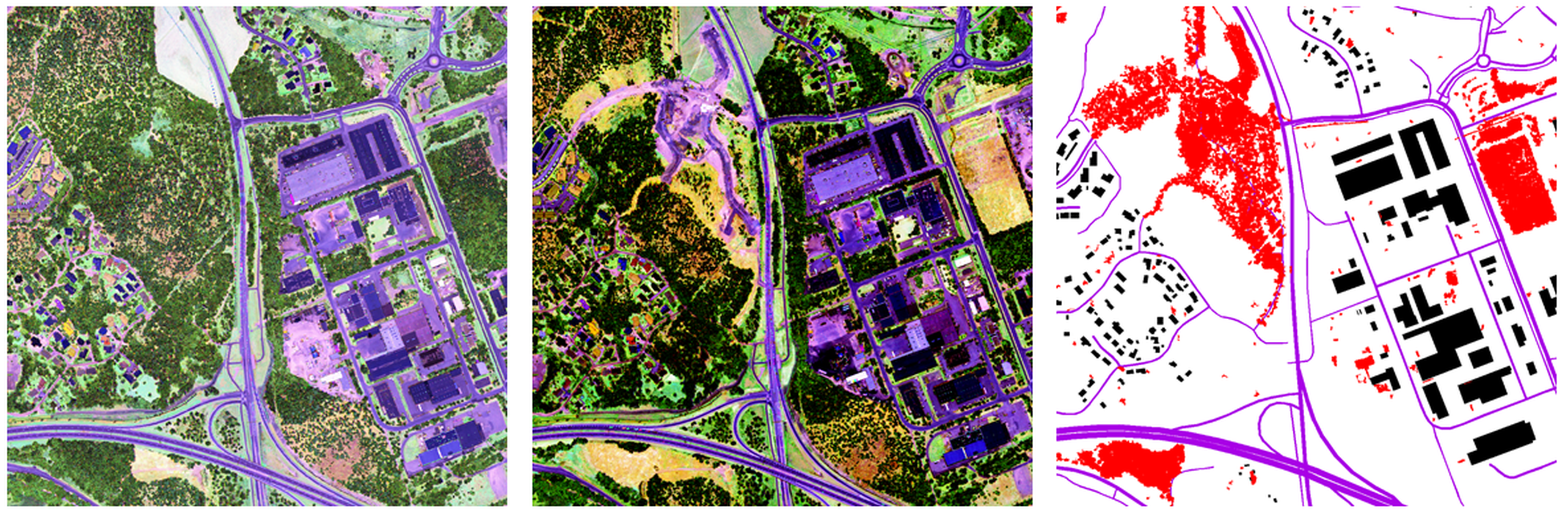
Intensity images from Optech Titan airborne laser scanner data from two dates and automatically detected changes presented in red colour with map data.
National Land Survey of Finland
The following credit must be given in figure caption or otherwise with the figure: “Finnish Geospatial Research Institute FGI, The National Land Survey of Finland; Contains data from the National Land Survey of Finland Topographic database 2015.”
 National Land Survey of Finland