News and articles
-
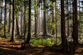
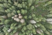 Read more about Drones are used to detect spruce bark beetle’s damage to trees faster than before
Drones are used to detect spruce bark beetle’s damage to trees faster than before
Researchers at the National Land Survey of Finland have developed an artificial intelligence method that helps detect the early signs of damage faster.
Press releaseResearchFinnish Geospatial Research Institute (FGI) -
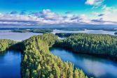 Read more about Use geospatial data to enrich your hiking experience
Use geospatial data to enrich your hiking experience
In Paikkatietoikkuna sercive, you can plan your upcoming hikes by saving hiking or jogging trails.
Spatial dataMapsPress release -
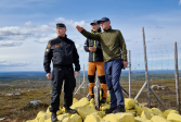 Read more about The review of the state boundary between Finland and Norway is nearing completion – the final inspection of terrain work is complete
The review of the state boundary between Finland and Norway is nearing completion – the final inspection of terrain work is complete
The Finnish and Norwegian border commissions completed the final inspection of terrain work on the national border between Finland and Norway in June.
MapsSpatial dataSurveying -
 Read more about How strong is gravity in Lapland and do you know what it affects?
How strong is gravity in Lapland and do you know what it affects?
Finland’s gravity is in constant motion which is why researchers from the Finnish Geospatial Research Institute (FGI) of the National Land Survey of Finland (NLS) measure it every year.
ResearchFinnish Geospatial Research Institute (FGI)Press release -
 Read more about What does the future of location-based services look like? Three points
What does the future of location-based services look like? Three points
Location Based Services 2025 (LBS2025) provided insights into what is happening in the growing field and what kind of opportunities the development will bring.
ResearchFinnish Geospatial Research Institute (FGI) -
 Read more about Data on individual trees to become available in the forest sector
Data on individual trees to become available in the forest sector
The NLS and the Finnish Forest Centre have started a joint research project to diversify and specify data on forest resources at the level of individual trees. In the coming years, data on forest changes and biodiversity will be required to monitor EU obligations, among other uses.
Press releaseResearchLaser scanning -
 Read more about NLS’s Location Innovation Hub launches free online course on AI and geospatial data
NLS’s Location Innovation Hub launches free online course on AI and geospatial data
This new online training course introduces the use of artificial intelligence and location data in business, with a particular focus on SMEs.
-
 Read more about Disruptions in satellite positioning can cause extensive damage to society
Disruptions in satellite positioning can cause extensive damage to society
The EU has become aware of the need to improve preparedness, and the FGI, which studies satellite positioning interference, has also identified this need.
ResearchFinnish Geospatial Research Institute (FGI)Press release -
 Read more about Osakehuoneistorekisteri.fi closes on 16 June
Osakehuoneistorekisteri.fi closes on 16 June
The website originally established for the Residential and Commercial Property Information System project will be closed on Monday 16 June.
Residential and Commercial Property Information SystemApartments -
 Read more about Data balance sheet: 64 per cent of mortgage cases were resolved automatically
Data balance sheet: 64 per cent of mortgage cases were resolved automatically
The data balance sheet highlights automated decision making, or more formally, the automated resolution procedure.
NLSSustainability
More information
For media
Our Communication Services assist media representatives in finding needed information, photographs and experts.