− Using geospatial data when planning a hike will make the hike safer and more pleasant. When hikers know exactly where they are going and what to expect, they can focus on enjoying nature and the experiences it can offer, says Riikka Kivekäs, a specialist at the National Land Survey of Finland.
To find an interesting hiking area that suits your needs, you can use Paikkatietoikkuna, the map service of the National Land Survey of Finland, which contains more than 3,000 map layers from different data providers.
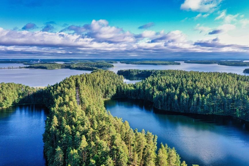
Plan your route with the tools available in Paikkatietoikkuna
In Paikkatietoikkuna, you can plan your upcoming hikes by saving hiking or jogging trails, as well as other destinations of interest to you. You can sketch your routes on the map by drawing dots and lines, and measure distances using the measurement tool. With the terrain profile tool, you can view the elevation differences along each route to decide whether you want to have a relaxed hike on flat terrain or work up a sweat on steep hills. You can also share your planned route with your hiking buddies or other people who might be interested in it.
By viewing Paikkatietoikkuna’s different map layers, you can familiarise yourself with a new area and find new interesting destinations even in familiar areas.
− The map layers that are of interest to a hiker include the topographic map, which shows information such as whether there are any marshy areas, rock masses and fields along a route, the orthophotos or compilations of aerial photos which correspond to the geometry of the map, and the hill shading images, which show elevation differences in a visual format, Kivekäs explains.
If you have a smartwatch or another device that records your route, you can view your route on the map afterwards by uploading it to Paikkatietoikkuna.
Historical sites and in-depth knowledge about surrounding nature
On the map in Paikkatietoikkuna, you can view many interesting historical sites, such as ancient monuments, traces of the Ice Age and archaeological sites. You will also find cultural and building heritage sites on the map, including UNESCO World Heritage Sites such as the Struve Geodetic Arc.
- One of our most popular map layers are historical aerial photos which allow you to dive into the local history. In Paikkatietoikkuna, you can compare current and old aerial photos, as the different map layers can be viewed on top of each other or side by side, Kivekäs points out.
Paikkatietoikkuna offers more information about the surrounding nature regardless of whether you are planning a trip or already out in nature. For example, the service shows areas belonging to the Natura 2000 network, state-owned nature conservation areas and marine nature conservation areas. The different map layers also provide information about the locations of different biotopes and the age of trees.
– You should also make use of Paikkatietoikkuna with your phone’s browser when moving around in nature. You can use the positioning button to see your current location and also what the different map layers tell you about the environment, Kivekäs advises.
Don’t get lost in the woods
Poor network coverage may come as a surprise in the forest, which is why it is always a good idea to take a printout of the map with you, or at the very least save a screenshot of the map on your phone. You should also keep in mind that not everything in the forest can be seen on the map and that the natural environment is constantly changing.
– The topographic map in Paikkatietoikkuna works well when navigating in the forest. For example, the service shows all trails included in the National Land Survey of Finland’s Topographic Database. However, there is no comprehensive information about all trails. There are always more crossing trails in the forest than can be seen on the map, Kivekäs points out.
Downloading the 112 Suomi app to your phone in case of an emergency is also a good idea, as it will allow the rescue services to more easily find you in the wild. It will show your exact coordinates to the emergency response centre.