We are studying the variable loading caused by the Baltic Sea. The level of the Baltic Sea varies due to water being exchanged through the Danish Straits; this variation is several dozen centimetres. A change of 10 cm in the level of the Baltic corresponds to 40 km3 in volume. Changes in the wind and air pressure can cause the local sea level to vary by up to 2 m at hourly-to-daily intervals. Sea level heights are measured with automatic tide gauges and are available in near real-time. We have used heights provided by BOOS (Baltic Operational Oceanographic Service, http://www.boos.org). The sea level heights are used to compute an instantaneous surface over the Baltic Sea, from coast to coast. The loading effect at a certain measurement point depends on the sea level height (amount of load) and distance to the coast.
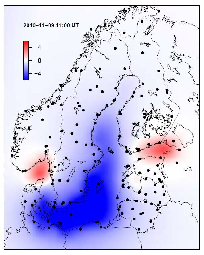
During the first phase of the study, we are computing the loading effect due to Baltic Sea at different geodetic measurement points between February 2008 and December 2012. We show the vertical deformation due to Baltic Sea loading in millimetres over Fennoscandia on 9 November 2010 at 11 o’clock compared to the mean sea level condition. The black dots show the locations of the stations for which the loading time series have been computed.
The time series for the geodetic GPS or absolute gravity can be made more reliable by removing the known loading effects. A more reliable and accurate time series provides in turn, for example, more accurate land uplift rates. In related studies, we are investigating the loading effects due to the atmosphere, continental water storage and snow.