BONUS BASMATI – Baltic Sea Maritime Spatial Planning for Sustainable Ecosystem Services
In the BONUS BASMATI project, innovative solutions are being designed for the development of maritime spatial planning in the Baltic Sea region. To support these efforts, the Finnish Geospatial Research Institute (FGI) is developing the interactive Baltic Explorer system. The BONUS BASMATI project is an international venture funded by the Academy of Finland, the EU and BONUS (Baltic Organisations’ Network for Funding Science). Participants in the project include research institutes and universities from five different countries in the Baltic Sea region.
The goal of this maritime spatial planning project is to prevent conflicts from arising, and to harmonise human activities with nature in as sustainable a way as possible. The planning project involves planning efforts at both a local level and the level of the entire Baltic Sea region.
The project is predicated on the participation of stakeholder groups in the Baltic Sea region, and the participants include a wide range of such stakeholder groups: decision makers, maritime planners, representatives from industrial groups and the fishing sector, and more. The level of international cooperation in the project has been considerable, and one of the shared goals is for BONUS BASMATI to be beneficially used by all people and institutions who make use of the Baltic Sea area.
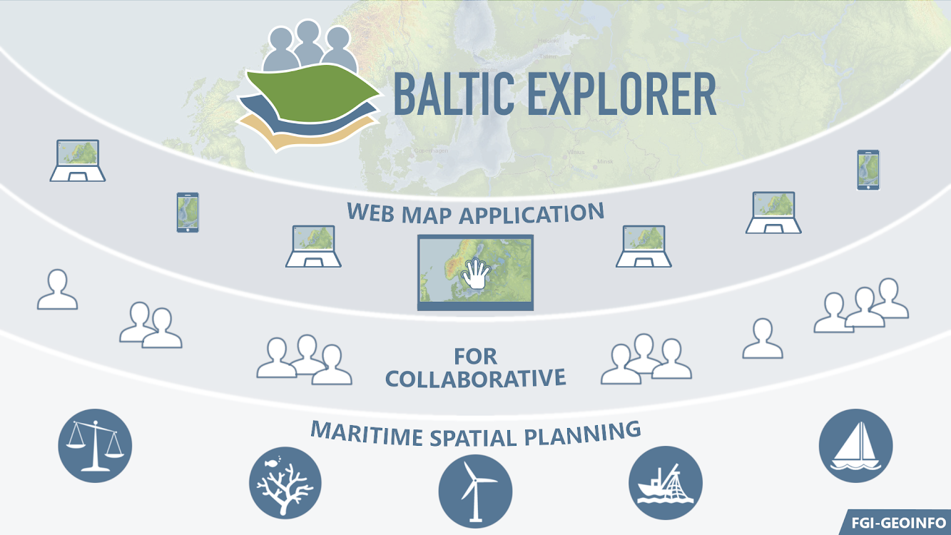
Baltic Explorer – an advanced maritime spatial planning tool
Baltic Explorer, developed by the Finnish Geospatial Research Institute (FGI), is a collaborative web map tool intended to support the joint efforts in this field. Baltic Explorer is a tool for utilising maritime spatial planning data, and for performing impact assessments and suitability analyses.
From the beginning, the goal in designing this tool has been to create an interface that is as easy to use as possible, and compatible with a range of different devices. The tool allows one to assess the impact of the maritime spatial planning work on Baltic ecosystem services (i.e., the benefits that the Baltic Sea provides to people).
Baltic Explorer is a state-of-the-art support system for decision making and is now used by many of the stakeholder groups in the maritime spatial planning project. The interactivity of the tool facilitates cooperative work among the project’s stakeholder groups, as well as collaboration between different countries.
A prototype of Baltic Explorer has been made public and can be viewed at balticexplorer.eu. At the conclusion of the project, the tool will be published as open-source software. In addition to Baltic Explorer, the project has seen the development of other maritime spatial planning tools as well.
Assessing the impact of maritime spatial planning, and new data
Assessment of the impact of maritime spatial planning is a key part of this project. The impact of the project is being facilitated and assessed through international case studies. Local-level case studies are taking place on the Fehmarn Strait and the Gulf of Riga, alongside a supranational study of the entire Baltic.
During the implementation of the project until 2020, new data will be produced and tested in assessments corresponding to policy goals to support the combined analysis of the four elements of the concept of ecosystem services: provisioning, regulating, cultural and supporting services.
BONUS-project video: https://youtu.be/TWSBr1zm8Ao
![]()
![]()
Contact persons
Members
Duration
Departments
Research area
Funding organisation or partners
FGI
Academy of Finland
EU
Other funding sources
BONUS
Project partners
Aalborg University, Denmark (AAU)
Aarhus University, Denmark (AU)
Nordregio, Sweden (Nordregio)
University of Turku, Finland (UTU)
Latvian Institute of Aquatic Ecology, Latvia (LIAE)
Leibniz institute for Baltic Sea Research, Germany (IOW)
Links