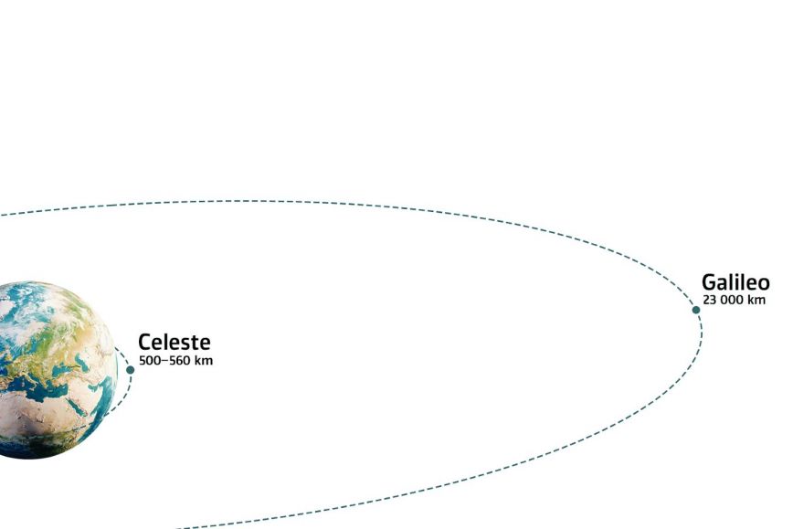
The main global navigation satellite systems are the United States’ GPS, Europe’s Galileo, China’s BeiDou, and Russia’s GLONASS. The European Space Agency is currently developing and testing a new system, Celeste—named after Galileo Galilei’s daughter—which operates in low Earth orbits than traditional GNSS constellations.
Signals that reach even disturbance-prone environments
The new satellites in ESA’s Celeste mission will complement traditional GNSS by providing stronger and more resilient navigation signals from LEO, especially in environments where existing signals are weak, obstructed or vulnerable to interference.
- Traditional navigation signals may be compromised in dense urban environments, indoors, and at northern latitudes. Researchers regard LEO-based positioning as a promising means of improving resilience, as the availability of multiple frequencies makes intentional interference more challenging, says Sanna Kaasalainen from the Finnish Geospatial Research Institute FGI.
The first two satellites of the European Space Agency's Celeste mission were launched on 28 March 2026 with Rocket Lab's Electron rocket from the Māhia Launch Centre in New Zealand. Since launch, the satellites have operated as planned and the European Space Agency has begun to receive the first navigation signals from the Celeste mission.
Advanced technologies and new frequency bands
The Celeste mission is testing several advanced satellite-navigation technologies, including new navigation signals across multiple frequency bands and autonomous precise orbit determination independent of ground infrastructure.
The first two satellites will validate core technologies and bring into use the mission’s required L- and S-band frequencies, while the rest of the 11-satellite demonstration constellation will extend experimentation to additional bands, including C-band and UHF.
“We expect Celeste to significantly improve the resilience, accuracy and availability of position, navigation and timing. These benefits will be achieved through higher signal power and, once the full constellation is operational, a multi-layer satellite architecture, among other factors,” says Research Professor Zahidul Bhuiyan of FGI.
The first two satellites, built in Europe, mark the beginning of a broader Celeste constellation. The mission will provide valuable insight into the system architecture, signal design and operational requirements of a permanent LEO satellite layer alongside Galileo.
Further information
Director of Navigation and Positioning Sanna Kaasalainen, Finnish Geospatial Research Institute FGI, +358 50 369 6806, firstname.lastname@nls.fi
Zahidul Bhuiyan, Research Professor, Finnish Geospatial Research Institute (FGI) of the National Land Survey of Finland, +358 50 372 6569, firstname.lastname@nls.fi
This news article does not represent the views of ESA. The responsibility for the content lies with the author or organization that produced it.