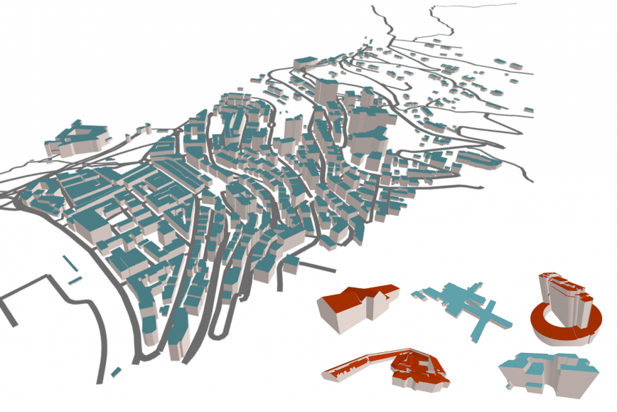
Location Europe is the first platform that brings the climate, statistical and geospatial data of different European countries together in a single place.
It responds to the need recognised in the European Union: We urgently need tools to merge various data and to make data better available so that companies can more easily build solutions that facilitate the green transition. The platform is home to data about the properties of buildings and average temperatures, for example.
‘There must be several companies in Finland that have the will and skill to develop solutions that improve, say, the energy efficiency of buildings. Until now, data must have been collected from various sources which consumes both time and resources. Location Europe responds to this need,’ says Project Manager Antti Jakobsson.
The platform’s data can be examined in a standard map view or used through an interface. Various visualisations and models can help direct energy renovations more effectively at buildings where they are most urgently required.
Cross-border business potential
Location Europe also speeds up Finnish companies in developing international business, as operations can easily be expanded abroad without any significant changes using cross-border data. In addition to Finland, the Netherlands, Spain, Norway and Estonia have participated in the development of the platform.
‘We need cross-border cooperation to build a sustainable Europe. Hopefully, the platform also helps build new markets and business. In addition to the built environment, potential uses are offered by agriculture and forestry, as well as logistics,’ Jakobsson says.
The platform can now be tested by companies and public organisations. Its development started in the EU-funded GeoE3 project, which will end in February. After this, platform management will transfer to the Location Innovation Hub. The Location Innovation Hub is a centre of excellence which helps companies develop their business using geospatial data. The Finnish Geospatial Research Institute (FGI) of the NLS coordinates its activities.
Further information
Antti Jakobsson, Project Manager, firstname.lastname@nls.fi, +358 50 599 4123 (on holiday until 17 December)
Lassi Lehto, Research Manager, firstname.lastname@nls.fi, +358 50 572 1611