Drought and water scarcity have extended all the way to Europe. Drought has even caused desertification around the Mediterranean. The direct and indirect impact of drought is also reflected in Finland. The impact of extreme weather and the shorter snow and frost season on water systems and, say, the quality of fresh water, as well as people, farmers and forest owners around water systems, is difficult to predict.
The Digital Waters flagship will be launched in Finland to increase proactivity. Its goal is to provide top research and innovation to protect water resources. It will also generate digital twins of water systems to assess the impact of decision making.
World Bank: more accurate digital information about nature is required
According to the World Bank, digital information about nature is required to facilitate decision making. Currently, the value of the global water industry is estimated at EUR 400–500 billion per year. Correspondingly, the value of Finland’s water industry is roughly EUR 4 billion.
‘This Digital Waters flagship will significantly help to obtain accurate digital information about water. So far, FGI has been part of studying and developing methods to collect digital information about forests and other natural environments, including even berries,’ says Research Professor Harri Kaartinen.
The flagship is coordinated by the University of Oulu and funded by the Academy of Finland. In addition to FGI, its partners include the University of Turku, Aalto University, the Finnish Environment Institute and the Finnish Meteorological Institute (FMI). The partnership engages Finnish research infrastructures, international research organisations, almost 200 companies, as well as public and non-governmental organisations.
A digital river shows how decisions affect an actual river
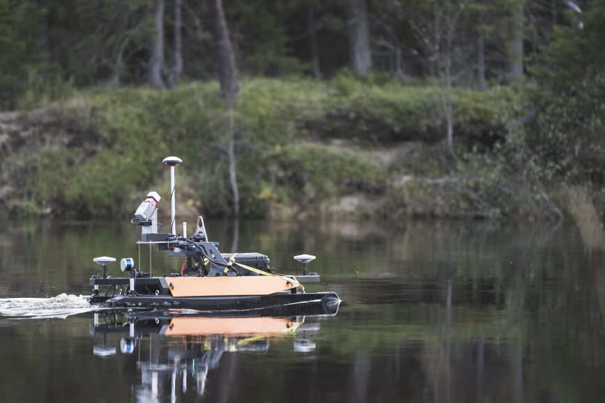
A key goal of the Digital Waters flagship is to generate digital versions of water systems – digital twins. FGI can offer its special expertise for this, including the harmonisation and shared use of geospatial data, as well as remote sensing, laser scanning and 3D modelling. FGI has already previously been engaged in digital water cooperation with nearly all of the organisations participating in the flagship. The FMI is a key new partner.
‘Rapidly developing sensor technologies and the resulting development of methods offer new opportunities for the more effective mapping of water environments. The diverse sensor range of FGI and the partners will also be an important part of building and operating digital twins, as it also forms the basis of achieving the flagship’s goals,’ Kaartinen says.
FGI has also developed water-related data management and map services and provided scientific results for society and companies.
‘Larger sets of measuring data that are also more diverse and accurate before require effective methods for data management, analysis, further processing and distribution to enable digital twins to serve various user groups as effectively as possible. Innovative easy-to-use visualisation methods allow analysis results to be used in decision making, among others,’ says Professor Juha Oksanen, Head of Department, Geoinformatics and Cartography, at FGI.
More information
Research Professor, Harri Kaartinen, 029 531 4756, firstname.lastname@nls.fi
Head of Department, Geoinformatics and Cartography, professor Juha Oksanen, +358 40 831 4092, firstname.lastname@nls.fi
![]()
Research Council of Finland's flagship programme-funded Digital Waters (DIWA) flagship enables green and digital transition towards digital twins for catchement areas. The work is carried out by University of Oulu, University of Turku, Aalto University, Finnish Environment Institute, Finnish Geospatial Research Institute FGI and Finnish Meteorological Institute, with a wide network of other operators in the water sector.