
This year, the FOSS4G event will take place in Florence in Italy. The spearheads of NLS’s presentation will be the Oskari software, long considered the “crown jewel” of open-source map platforms; the utilisation of automation and AI in the production of topographic data as a new area of interest; and the distribution technology of historical aerial photos, which garnered a great deal of interest last summer. Other topics to be presented to the international audience are the development work of the topographic data production system and the administration of the aerial photo registry by utilising the QGIS software.
Presenting new innovative functionalities
Oskari is an open-source code software for creating web-based maps and presenting and analysing geospatial data. For years now, Oskari has enjoyed a great deal of international interest, and the software will be demonstrated in a half-day workshop on Monday, as well as in two separate presentations held later in the week. The workshop will present the basics of Oskari software and its functionalities, and participants will get to design their own application utilising the RPC interface. One of the presentations is targeted at developers, and the other at end users.
“We have made some major improvements recently and created new features and functionalities in cooperation with partners like the Finnish Transport Infrastructure Agency. It will be a pleasure to present these new features to our international colleagues,” says Senior IT Specialist Sami Mäkinen.
Researcher Lingli Zhu will present the research work and the different methods of the Advanced Technology for National Map Updating (ATMU) project, which will help automate change detection of aerial photography in the future. The work utilises the stereo features of aerial photos and performs their change detection in a 3D view.
“I look forward to learning more about the development in the field and getting to know the people in the same business. Perhaps we can also find some new potential partners for future cooperation,” Zhu says.
Sharing expertise with the international community
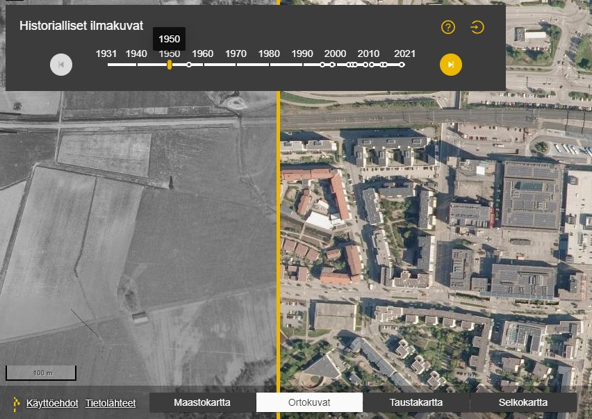
The historical aerial photos published in Paikkatietoikkuna have been quite a hit in Finland. The news article about the aerial photo archive being opened was read 75,000 times, and Paikkatietoikkuna also received a record-breaking number of visitors. At the FOSS4G event, IT Specialist Sini Pöytäniemi will address the software development process behind this publication work while shedding light on how some of the temporal and geographical challenges related to aerial photography were overcome.
“The attraction of the event comes from its multidisciplinary open-source code community, which is excited and inspired by the unlimited possibilities of open-source code and geospatial data. It’s great to be a part of a large community that is creating something new that will drive society forwards,” Pöytäniemi states.
Many of the key data systems of the National Land Survey of Finland are based on open-source code. The expertise collected over several years and the results achieved interest people. This expertise is also shared onwards.
“Open-source solutions provide the best results when we share our experiences and create solutions with our partners and the open-source code communities,” states Jani Kylmäaho, Director of Development and Digitalisation.
FOSS4G event
- FOSS4G is an abbreviation for “Free and Open-Source Software for Geospatial”.
- The event is organised by the Open Source Geospatial Foundation (OSGeo), which strives to increase the use of geospatial data software that is based on open-source code.
- The event is held in a different place around the world every year. The first event was held in Bangkok in Thailand in 2004.
Additional information
Director of Development and Digitalisation, Jani Kylmäaho, firstname.lastname@nls.fi
Department Director of Information Management, Jani Nissinen, firstname.lastname@nls.fi