In the ATMU project, artificial intelligence has been taught to automatically identify building and road data from aerial photography as well as water courses from laser scanning materials. The teaching materials published have been collected from five regions of different types, located in different parts of Finland. Some of these regions have more forests, while others are more urban in nature. The materials can be used by research and development projects to teach artificial intelligence how to identify the target objects, for example.
High-quality materials support development work
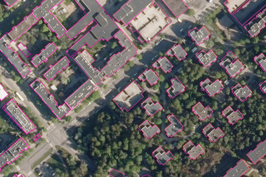
In many artificial intelligence projects – whether related to geospatial data or other subjects – the lack of of high-quality and comprehensive training data often bottlenecks the development process. In the ATMU project, diverse materials were collected to teach artificial intelligence. These induce “true orthophotos”, i.e. aerial photographs where objects are photographed directly from above without a tilting perspective caused by a camera. Furthermore, “labels” are also available from the same regions – buildings marked in the aerial photography data which help the AI to tell buildings apart from their surroundings. All in all, the material features more than 100 true orthophotos and their labels.
‘How well the machine is able to identify objects depends on the quality and quantity of the material it is trained. In ATMU, we have invested in high-quality training material. We hope that this investment will help and inspire also other researchers and operators in the geospatial data communities to develop AI applications for various needs of the society,’ says project manager Lingli Zhu from the National Land Survey of Finland's Geospatial Research Institute.
Assessed security
The training data can be downloaded from the NLS’s File download service, which provides the true orthophotos and labels in PNG image format.
‘Together with the defence administration, we have ensured that these openly available materials do not contain any threats to overall safety. If any organisation would like access to the more extensive training materials, we will agree on their disclosure separately. Please feel free to contact me directly in these types of questions,’ says Heli Laaksonen, the head of cartography at the National Land Survey of Finland.
More information
- Content of the training data: Lingli Zhu, tel. +358 50 430 1638
- Disclosure of the training data: Heli Laaksonen, tel. +358 40 098 8243
The email address format is firstname.lastname@nls.fi
Learn more about the project:
- Artificial intelligence and automation are changing the production of core geospatial data
- Development projects for core geospatial data