Versatile use of country-wide laser scanning data (VERSATILE)
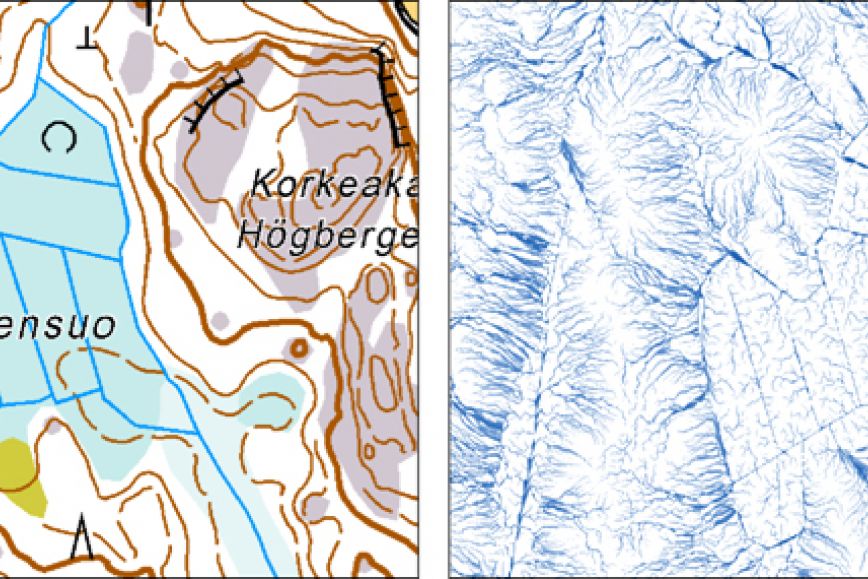
Country-wide laser scanning in Finland was started to fulfill the needs of detailed DEM production and flood risk mapping. However, due to the high quality of the LIDAR data there appears to be an enormous exploitation potential also in other application areas. This project aims at finding new versatile and innovative uses of national LIDAR data reserve especially from the mapping perspective. In WP1, robust methods based on direct use of LIDAR point clouds for updating the hydrographic information and boundaries of terrain units will be developed. In WP2, demonstrator making use of the LIDAR data in an interactive visualization environment to increase the citizen awareness of flood risks will be made.
The proposed project will be done 2012-2013. During 2012 (10 person-months) the focus will be on the methodology related to point-clouds and elevation models, efficiency of the algorithms and possibilities to exploit the results in development and updating of the National topographic database. During 2013 (10 person-months) the focus will be shifted towards the development work aiming at the tool supporting visual analytics of the flood risk potential.
The project results benefit the development and updating of spatial data infrastructures, especially the Topographic database, as well as all end users of the country-wide LIDAR data.
Contact persons
Keywords
hydrography
digital elevation model
updating
Duration
Departments
Research area
Research groups
-
Analysis and visualisation of geospatial data (GeoVA)
Read more about Analysis and visualisation of geospatial data (GeoVA)
Funding organisation or partners
FGI
Other funding sources
Ministry of Agriculture and Forestry