This summer, researchers from FGI will measure Finland’s gravity in four different locations in Lapland. The aim is to monitor changes in gravity and produce up-to-date gravity data.
‘We monitor how gravity changes each year. Changes in gravity are affected by several factors such as land uplift. When land rises, the distance from the centre of Earth also changes, reducing the force of gravity. It is important to monitor these changes, as up-to-date data is essential for the gravitational system, the altitude system and the geoid model, the maintenance of which is one of the NLS’s key tasks,’ says Mirjam Bilker-Koivula, Research Group Manager at FGI.
Gravity data to meet demand across Finland
Various activities in society depend on reliable and accurate measurement data. Gravity-based data is needed, for example, in satellite positioning, water supply and sewerage. In construction, data is needed to assess the stability of the ground surface. Gravity data is also used in the exploration of minerals and other natural resources, as well as in the monitoring of earthquakes and volcanoes.
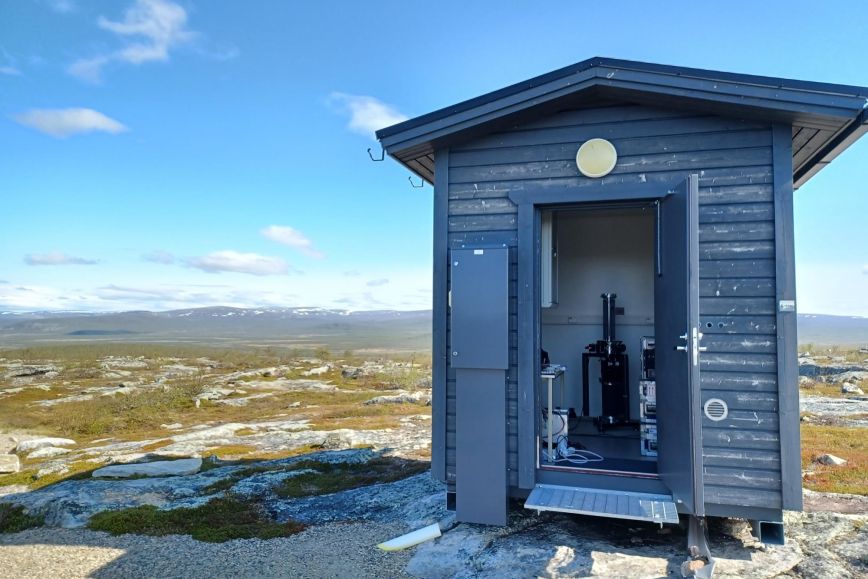
Researchers conduct measurements using an absolute gravimeter, a device that accurately measures the absolute value of gravitational acceleration. The absolute gravimeter travels with the researchers as an important instrument from one location to another.
Researchers from the NLS conduct gravity measurements at GNSS satellite positioning stations across Finland. Every year, the NLS conducts measurements at 6–7 stations, so that in three years, measurements are carried out at 20 GNSS stations in total. This year is Lapland’s turn. During summer, researchers will conduct measurements in Kolari, Sodankylä, Savukoski and Sinettätunturi in Enontekiö. The measurements conducted at GNSS stations in Lapland ensure that data covers the whole of Finland.
Further information
Mirjam Bilker-Koivula, D.Sc. (Tech.), Research Group Manager, +029 531 4696
firstname.lastname@nls.fi