Collaborative positioning and situational awareness (FGI-COPS)
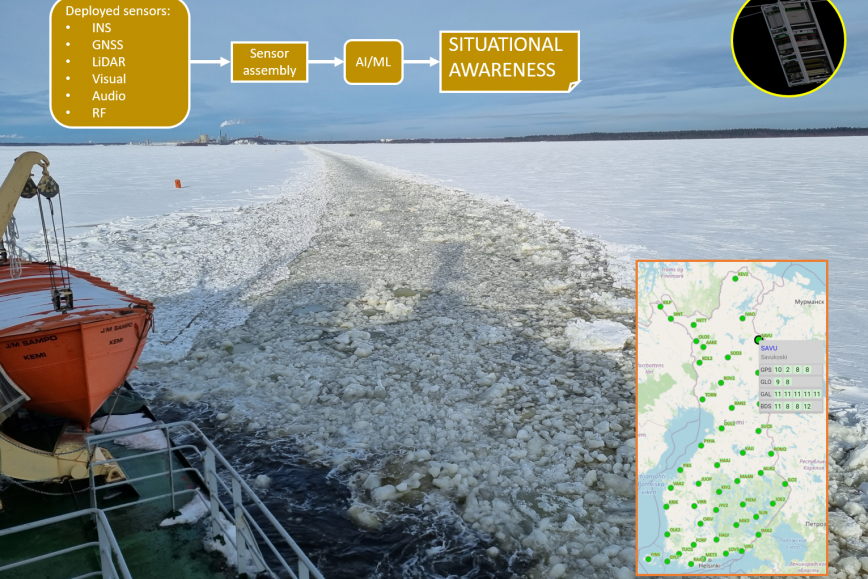
Collaborative positioning and situational awareness -research group (FGI-COPS) is working on situational awareness in different scenarios using satellite positioning i.e. signals from GNSS satellites, in particular from Galileo (including PRS) and hybrid identification data from different sensors. The sensors that can be utilized are e.g. inertial, optical, and radio frequency sensors as well as LiDAR, so called light radar. Scenarios may range from pedestrians carrying sensors in their equipment to autonomous situational awareness of vessels. Collaborative positioning serves as an umbrella term, which also includes smart transport amongst other things.
The group’s field of activity also includes finding solutions to GNSS disruptions. The research team utilizes the GNSS Finland service to detect disturbances. The service is open to everyone and is developed by the department of Navigation and positioning. Solutions can also be completely independent of satellite positioning and be based, for example, on other opportunistic signals in the environment, especially on radio frequencies.
FGI-COPS makes extensive use of hybrid positioning to create situational awareness in tactical, safety, and smart transportation applications, especially in challenging conditions, such as maritime winter navigation. Lower earth orbit LEO small satellites, so-called Cubesats, offer the potential for a wide range of new applications, for example indoors, where traditional GNSS signal is not available.