LYSTRA - Awareness and activities in the World Natural Heritage Site High Coast and Kvarken Archipelago
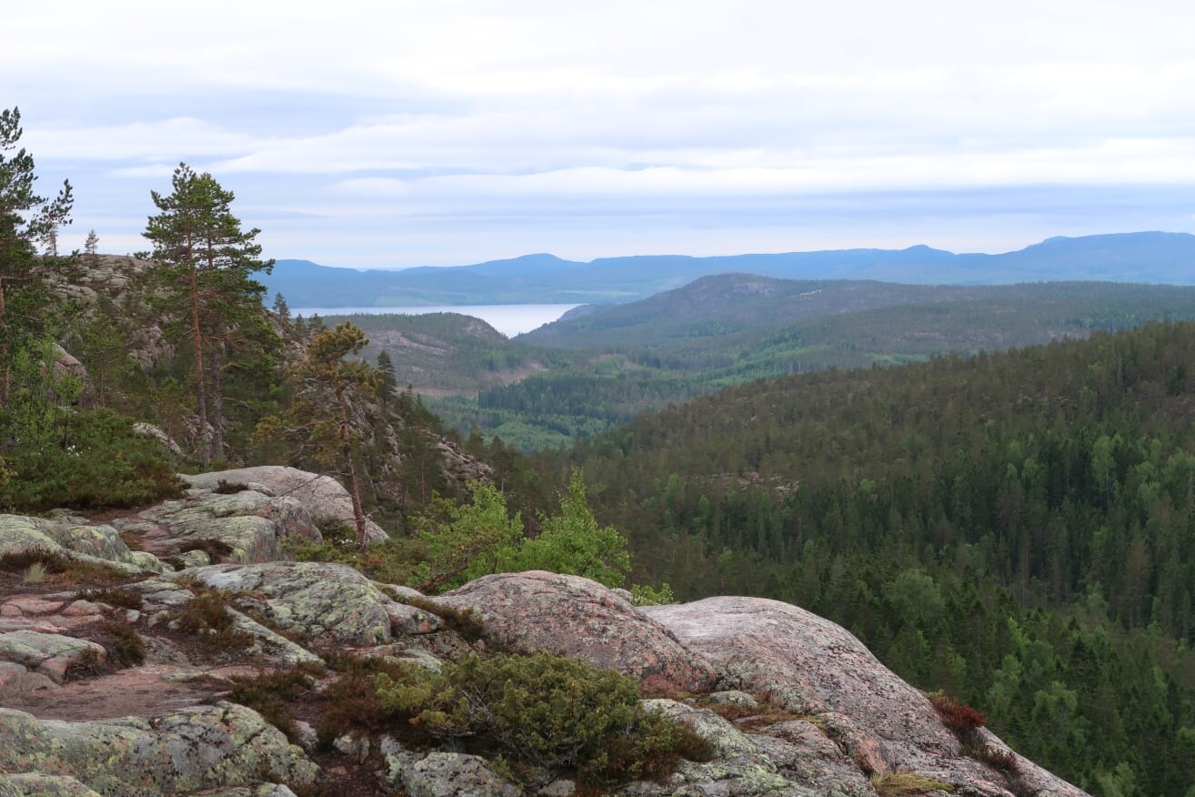
The Botnia-Atlantica programme’s Lystra project, a joint venture between numerous Finnish and Swedish partners, is intended to nurture and develop the High Coast and Kvarken UNESCO World Heritage Site. The Kvarken Archipelago (on the Finnish side) and the High Coast (on the Swedish side) together form a shared World Heritage Site. The Kvarken Archipelago is one of Finland’s seven World Heritage Sites, and its only Natural Heritage Site.
A key aim of the Lystra project is to increase the recognition of this World Heritage Site, and promote related business, while at the same time helping to ensure the sustainable development of the area. Increasing the site’s accessibility is one of the major goals of the project. Improved accessibility will benefit residents of the area, tourists visiting the area, and local business alike. This goal also encompasses the effort to increase understanding of the World Heritage Site’s value, and to develop a high-level repository of information that can be used by ecotourism businesses and land-use planners.
The EU-funded Lystra project aims to develop the High Coast and the Kvarken Archipelago, which have together been designated a World Heritage Site.
The Lystra project is intended to increase knowledge about the uplift occurring in the area and the consequences thereof, emphasising the uniqueness and value of the area. The exceptionally rapid uplift seen in the area is a consequence of heavy depression of the land in the last glacial period, from which the land is still recovering now.
There is reason to invest in this World Heritage Site. The uplift in the area of the Kvarken Archipelago and High Coast has been measured to be occurring at a rate of more than 8 mm (relative to the sea level) per year. Over time, this process will eventually create a walkable “bridge” between Sweden and Finland, in the northern part of the Kvarken Archipelago.
Results of the Lystra project
The international cooperation in the project has been a success. Among the concrete results of the project is a geological animation produced by the Finnish Geospatial Research Institute (FGI), which will be made public at the GIS Expo in the autumn of 2019. The animation visualises the uplift process from past times up to the present, and also projects far into the future, concretely modelling how massive a phenomenon this uplift is. In addition to the uplift, the animation models glacier movement. The animation was developed by FGI research scientist Viljami Perheentupa.
The data collected for the animation comes from digital elevation data measured through airborne laser scanning, carried out in Finland and Sweden. Airborne laser scanning is 3D scanning done from the air, in which laser pulses are sent down to the land below, and on this basis, an elevation model of the earth’s surface in the scanned area is assembled.
” The uplift phenomenon, and its consequences, can be seen in the best possible way in the area of the Kvarken archipelago and the High Coast, which, in a geologically interesting way, are each other's opposites,” Viljami Perheentupa states.
In the project, an interpretation plan is being prepared for nature- and cultural guides, and guides on the World Heritage area. The interpretation plan takes the distinctive features of the various different walking sites into consideration. The workability of the interpretation plan, and the comprehensibility of the message given about the World Heritage Site, are currently being evaluated in Finland and Sweden, through walker questionnaires and other means. The development of the accessibility and activity of this valuable World Heritage Site has been a key priority in the preparation of the guide plan.
Another result of the Lystra project is the open web portal, currently still in preparation, where extensive information on the World Heritage Site will be available. In the web portal, it is also possible to implement an interactive map illustrating the area. Besides the public-level web portal, a dedicated platform is also being developed for professionals in the geospatial field, which will allow for (e.g.) the sharing of data.
LYSTRA-Project video: https://youtu.be/9OEzO86S_iw
Land uplift animation: https://www.youtube.com/watch?v=TpwfCDlo7jg
" data-entity-type="file" data-entity-uuid="63664dec-d18c-49ac-ba6c-c094771c4025" src="//www.maanmittauslaitos.fi/sites/maanmittauslaitos.fi/files/inline-images/future1000_0.png">
Contact persons
Keywords
land uplift
geodesy
cartography
geodynamics
land use
maps
Duration
Research area
Funding organisation or partners
FGI
EU
Other funding sources
EU rahoituksen lähde: Interreg Botnia Atlantica
Pohjanmaan liitto
Metsähallitus
Geologian tutkimuskeskus
Maanmittauslaitos FGI
Vaasan kaupunki
Visit Vaasa
Merenkurkun maailmanperintö ry
Västernorrlannin lääninhallitus
Naturvårdsverket
Kramfors kommun
Örnsköldsvik kommun
Sveriges Geologiska Undersökning
Project partners
Metsähallitus
Geologian tutkimuskeskus GTK
Vaasan kaupunki
Sveriges Geologiska Undersökning SGU
Länsstyrelsen i Västernorrland