A total of 47 base stations for satellite positioning have been placed across the country. Together, they form the FinnRef network, which is maintained by the National Land Survey of Finland (NLS). FinnRef’s purpose is to form the basis of Finnish reference systems and provide accurate geospatial data for daily needs in society.
Satellite positioning and its availability and quality are critical factors in the financial sector, the operation of power grids, and data transfers, among others.
’Using satellite positioning, or GNSS services, the efficiency of several societal fields, including transport and agriculture, can be optimised. For example, agriculture is more efficient when farm machines use satellite positioning on their routes,’ says Marko Ollikainen, Senior Specialist at the NLS.
An enabler of accurate positioning
The FinnRef measuring station network is used to maintain coordinate systems that form the basis of Finnish geospatial data. The base stations’ observations serve to address any changes caused by the movement of the Earth’s crust and thus to ensure that the systems are up to date and linked to international systems.
’Finland’s bedrock is rising as a result of land uplift. FinnRef helps researchers monitor the movements of the Earth’s crust, including land uplift and tectonic plate movements. In this way, we can respond to their impact on positioning,’ says Hannu Koivula, Director of Geodesy and Geodynamics at the Finnish Geospatial Research Institute (FGI) of the NLS.
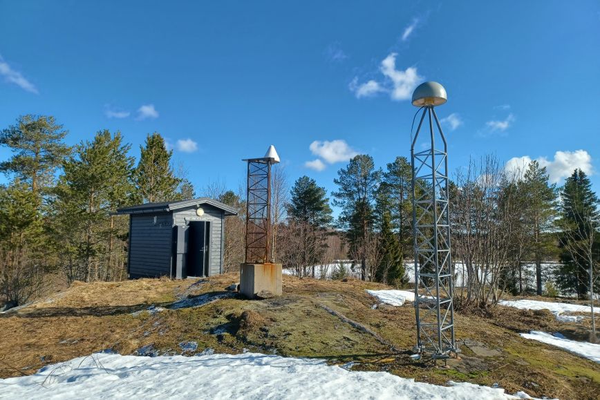
FinnRef also serves daily users of geospatial data, with the base stations improving their positioning accuracy. The FinnRef base stations receive data transmitted by positioning satellites, which as such is not sufficiently accurate for all needs. FINPOS services based on the FinnRef base station network can reduce any errors in satellite positioning. The DGNSS and RINEX services are available to everyone online. Other available services include the RTK service for research and testing, and the raw data service which carries a charge.
FinnRef accelerates the use of geospatial data
The establishment of the FinnRef network some 30 years ago at the beginning of the 1990s raised the accuracy of positioning to a whole new level. The increase in GPS positioning created a need for a permanent GPS network.
From the end of the 1980s, the goal in Europe was to build a single coordinate system to facilitate the production of datasets, statistics and maps. As a result of this development, the European ETRS89 reference system was established in Europe and its realisation EUREF-FIN in Finland.
Finland’s FinnRef stations form the framework of the national EUREF-FIN coordinate system. They also act as a link between national and international coordinate systems.
The network of the FinnRef base stations has been developed throughout its existence whenever the use of geospatial data in society has increased.
Currently, the network consists of 47 stations furnished with modern equipment, for which E1 coordinates of the highest category have been defined. According to the national geodesy strategy, the stations will also form the framework of the elevation and gravity system in the future.
Even though the Earth’s crust moves, Finland’s positioning accuracy will also be standing on firm ground in the future thanks to high-quality research and its modern infrastructure.