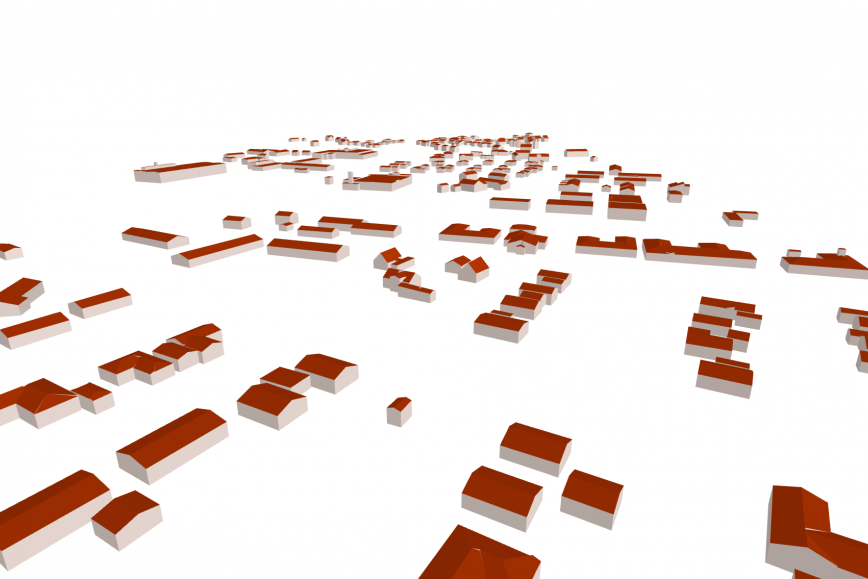
The three-dimensional models of buildings can be viewed in the Land Survey of Finland’s File service of open data. The models provide building owners with useful information that supports their energy renovations and adaptation to climate change.
The three-dimensional models can be used to estimate the solar energy potential of a building's roof and determine the best locations for installing the system.
The 3D buildings show the buildings’ exact height. When this height data of a building is combined with the elevation model of the terrain, the impact of changing water height of water areas on the flood risk can be assessed on a building-by-building basis.
When a building being designed can be seen as a 3D model as a part of the built environment, this enables understanding of its effects on shade, windiness and noise.
‘The information needs of society are constantly changing, and three-dimensional building information covering the whole country allows finding completely new uses for the information. The National Land Survey of Finland develops the data content of the core geospatial data together with the authorities, companies and other parties using the data,’ says Jani Kylmäaho, Director of Development and Digitalization at the National Land Survey of Finland.
Building and climate information from different sources linked to 3D buildings
‘As a rule, building and apartment data and climate data must still be obtained from different sources today, and the data must be combined based on either unique identifiers or location. In the future, utilising the data would be easier if uniform quality criteria were applied to it and if the data was interoperable and available through a single channel,’ Kylmäaho states.
Data has already been successfully combined in the European GeoE3 project, where Finland – together with Spain, Norway, Estonia and the Netherlands – created an online platform in which 3D buildings and building information can be viewed on a map. The 3D building data material produced by the National Land Survey of Finland combines building information such as the time of construction, material and heating system of public buildings. Climate data on average sunshine hours, temperatures and wind speeds has also been added to the materials. View the material on the project page.
Three-dimensional building models now available from one-sixth of Finland
The National Land Survey of Finland began to produce 3D models of buildings in 2021. Today, there is data available already from one-sixth of Finland. By the end of 2026, the whole of Finland will be laser scanned with the precision required for 3D modelling of buildings.
The National Land Survey of Finland produces the 3D building models from laser scanning materials, which are collected as part of the national laser scanning programme. The material is updated in six-year cycles. The national laser scanning and aerial photography programme will keep core geospatial data up to date, including information such as laser scanning data, altitude models, terrain data and basic positioning data. These are utilised in rescue services, national defence, agriculture and forestry, as well as by the construction and environment sectors, among others.
Laser scanning, aerial photography and 3D building material are used, for example, by the Finnish Forest Centre, Finnish Environment Institute, Metsähallitus, Finnish Food Safety Authority, Ministry of Agriculture and Forestry, Defence Forces and Ministry of the Environment for their own purposes.
Dense materials require a license
Since 2020, laser scanning data has been more accurate than before. From the point of view of state security, the Finnish Defence Forces and the National Land Survey of Finland agreed that this new dense scanning data will not be distributed as open data. The materials are public, but their use requires accepting the terms of use. The licence is subject to a fee and is granted for an area of 3,000 square kilometres at a time, which corresponds to an average of one production area per year.
New material is constantly being created as open, freely available material when the 0.5-point density version is thinned from the dense material.
You can view a map to see the progress of 3D modelling of buildings in Finland: https://tilannekartta.maanmittauslaitos.fi/3drakennukset
Download 3D materials of buildings in your area from the data service:
https://tiedostopalvelu.maanmittauslaitos.fi/tp/kartta
Explore the 3D models of buildings directly in your web browser (select Buildings3D from the top menu).
https://geoe3platform.eu