Demand for highly accurate geospatial data has increased significantly over the years as a result of autonomous driving, among others. The NLS’s project improved the accuracy of geospatial data in the Topographic Database, automated the collection of data, and ensured that data were up to date.
‘Any inaccuracies in building location data in the Topographic Database may result from technical restrictions, different accuracy requirements used at each time, and possible human errors,’ says Lingli Zhu, Project Manager at the NLS.
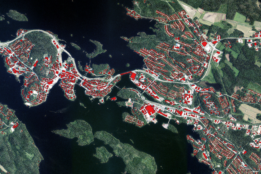
AI identifies buildings well
During the project, building location correction has been tested in 11 areas: Kuopio, Savonlinna, Lahti, Vaala, Uusikaarlepyy, Uusikaupunki, Ylitornio, Parainen, Riihimäki, Jyväskylä and Oulu. These covered a total area of 1,628 km2.
‘The building correction was implemented by comparing the TDB buildings with AI-derived buildings, and if the deviation and rotation were big, the TDB buildings were corrected. The AI-derived buildings were also used to identify the buildings that were missing from the Topographic Database or buildings that had been demolished,’ Zhu says.
While AI identifies buildings well, areas with a high coverage may be problematic. The identification of problematic buildings will be improved in the future by using laser scanning data.
Challenges in identifying watercourses
Watercourses have highly varying properties, causing challenges for AI. It turned out that ditches were easier to identify than other watercourses. Of ditches defined clearly in manual digitisation, 86–95% were identified.
Identifying natural streams was much more challenging, and ponds were even more difficult. They are often covered by trees, and their physical shape, including their edges, show significant variation.
‘The watercourses identified using AI can be generated into a comprehensive network of watercourses,’ Zhu says.
Seeking a higher quality in the Topographic Database
The Topographic Database is the only national geospatial database that contains geospatial data, for example building information, that are utilised widely by municipalities and other organisations. Municipalities can utilise building information in the Topographic Database to supplement their own data, in matters related to property taxation and address information, for example.
The upcoming improvements will significantly increase the quality of data in the Topographic Database and provide benefits in all sectors.
‘We can safely assume that there will be significantly fewer manual routines after the AI model has been trained using high-quality data covering most of Finland’s production areas,’ Zhu says.
Further information
Further information in English
Lingli Zhu, Project Manager, +358 50 430 1638
Further information in Finnish
Heli Laaksonen, Director, +358 50 574 6869
The email address format is firstname.lastname@nls.fi