There is a growing need for accurate and up-to-date information about the surrounding environment in social decision-making, for example in areas such as urban planning, transport and preparing for the consequences of climate change. By combining up-to-date information with location data, digital versions of the real world, i.e. digital twins, can be created. An example of a digital twin in use today is the real-time weather observations of the Finnish Meteorological Institute and the models made based on them. Another example is Fingrid's power grid management system. Additionally, a joint project of the Finnish Forest Centre, Metsähallitus and the National Land Survey is testing new possible resolutions of the national laser scanning and aerial photography programs, which will be used in the future to create the digital twin of forests.
National Land Survey’s datasets provide the basis for digital twins in Finland
The National Topographic Database of the NLS and the materials produced by the National Laser Scanning and Aerial Photography Programme can be used to produce up-to-date information for digital twins across the whole Finland. The National Land Survey's materials alone do not create a digital twin of Finland, but they can be used in the development and research of digital twins.
‘The National Land Survey of Finland produces country-wide location references that allow, for example, digital twins made from forests and cities to be linked to each other,’ says chief engineer Antti Jakobsson from the National Land Survey of Finland.
‘The information we produce is currently used by the Finnish Transport Infrastructure Agency, for example, which uses the road network to produce the Digiroad system. Another example is linking the geometry of buildings in the National Topographic Database with the building register of the Digital and Population Data Services Agency,’ he says.
High-quality research data promotes digital twins
Another important factor in the development of digital twins is the long-term background research work on geospatial data. It is carried out by the Finnish Geospatial Research Institute FGI, which develops digital twins and the methods needed for their creation.
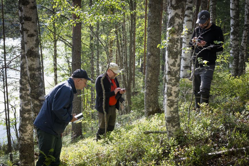
For example, the UNITE flagship project has developed methods to obtain information on forests at the level of individual trees. The Metsäkanta forest database’s map view enables users to view individual trees sorted by length and tree species. The system is currently open to test users.
‘The algorithm that identifies wood species is now in operation, and we estimate that the area laser scanned by the National Land Survey in Southern Finland in 2020–2022 will be calculated by the end of this year. There are an estimated 2 billion trees in this area, the diameter, species and volume of which can soon be viewed from the forest database,’ says Professor Juha Hyyppä, Head of the Department of Remote Sensing and Photogrammetry.
A digital twin of basin areas, such as rivers or streams, is also under development. It would provide information on flow volume and water quality, among other things. The digital twin of streams is being developed in the Green-Digi-Basin project of the Freshwater Competence Centre.
‘The digital twin of streams requires a new kind of technology that is able to produce real-time information about fluvial environments. The Hydro-RI-Platform research infrastructure of the Freshwater Competence Centre aims to meet this challenge, and strives to acquire equipment in Finland that will enable obtaining sufficiently accurate and up-to-date data. We also recently received the news, that our long-term work with the digital disruption of hydrologic research will take an important step forwards when our new eight-year-long Digital Water (DIWA) flagship starts’ says Harri Kaartinen, research professor at the Finnish Geospatial Research Institute.
Accurate and up-to-date information serves decision-making
‘When cross-industry digital twins can be linked together, it provides a way to view and analyse data together. In this case, parties representing different perspectives have the same knowledge base for their discussions, and the perspectives and decisions can be based on the best possible information. Before implementing the decisions, their effects can be simulated with the help of a virtual twin. These are important prerequisites for supporting public debate in matters related to forests, for example. They are also important when we prepare to tackle future challenges caused by climate change, such as forest fires or floods,’ says Heli Laaksonen, director of Core Spatial Data Services at the National Land Survey of Finland.
In the level of whole Finland, the development and interoperability of digital twins requires close cooperation. A good forum for promoting this is, for example, the Digital Twin Finland working group that is part of the Geoforum network. Future national aerial photography and laser scanning programmes are also planned together with a wide range of experts.
‘One of the goals is to produce national materials that serve Finnish digital twins as well as possible,’ Laaksonen says.
Come and hear how the digital twin of Finland is progressing! Digital twins is the topic at the National Land Survey's free seminar at the Geoforum Summit event on 31 October.
More information and registration here
Seminars 31 October.
10–10.45 Digital twins – Session 1: Digital Twin Finland concept as part of the Finnish Digital Compass (Heli Laaksonen)
10.00–12.00 noon Future of accurate positioning (Location Innovation Hub), free seminar
Bulletins 30 October
13.00–13.15 Juha Hyyppä, Forest Database, UNITE
14.15–14.30 Harri Kaartinen, Freshwater Competence Centre
You can also meet with the researchers at the NLS stand on Monday.
Hydro-RI-Platform and Green Digi Basin are funded by the European Union-NextGenerationEU

Academy of Finland funded flagship UNITE researches and develops the Forest-Human-Machine Interplay by for world’s leading research groups in forest sciences, spatial data and sensor development, as well as gamification. The UNITE is a consortium of School of Forest Sciences of University of Eastern Finland, Natural Resources Institute Finland, Finnish Geospatial Research Institute of National Land Survey of Finland and University of Tampere that cooperates with a large network of partners.