In May 2023, we sent a survey to all contractual customers of the National Land Survey of Finland’s (NLS) map image services (WMS and WMTS). We wanted to know what our customers think about the availability of the map image services and related communication and instructions. In addition, we asked what they think about the progress of the agreement process and the deployment of the services. We received a total of 77 responses that indicated satisfaction with services and presented a few development ideas. We would like to thank all respondents.
While customers, based on the responses, generally felt that the process of entering into an agreement flowed smoothly, we also received feedback on a slow agreement process and the manual steps related to it. Customers were most dissatisfied with the difficulty to find documents and user instructions on our website. There is a large number of various instructions, but the material available on the website was considered confusing and finding the correct information difficult.
The users of the map image services show significant diversity. Diversity can also be seen in different ways of using the services and in the customer software with which the services are used. Then again, this also presents challenges in the preparation of documents and instructions. Nevertheless, we would like everyone to be able to use our map image services and deploy them easily.
We are constantly developing the instructions available on the website. Our goal is that we could offer clearer instructions for the use of our API services and that different user groups could more easily find the information they need. The feedback received through the survey is valuable when we consider how we could support this goal even better.
The development of our activities and services is important to us. In addition to surveys, you can send us feedback easily using the contact form.
Map image services – what are they all about?
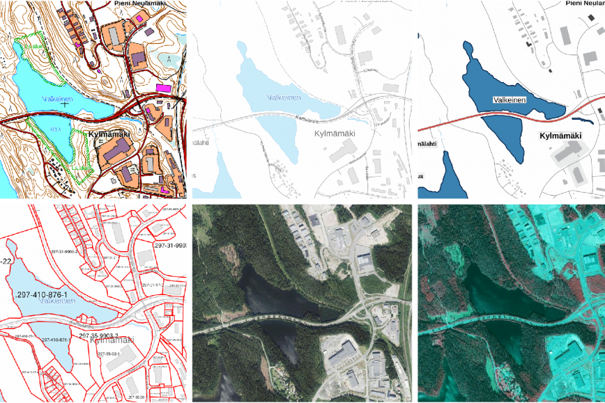
The NLS’s map image services offer the opportunity to use topographic, background and plain maps, orthophotos and property boundaries in various customer applications. The map image services area available as aPI’s based on WMS and WMTS standards through which products can be used as raster images. In addition, the services are available as a vector tile service, which enables presentation styles to be customised.
The map image services are among the NLS’s most popular API services. They have more than 400 contractual customers, and almost 4,000 customers use their open versions using an API key. The map image services are used broadly in client applications through which the data provided by the services are available to the public at large. As a good indication of the extensive use of the services, data are retrieved from the WMTS API several billions of times each year. The annual number of retrievals in the WMS API has been roughly 200 million.
Read more about the map image services on our website (in Finnish).