Many activities critical to society, such as rescue services, power grids and stock exchanges, require satellite positioning to function properly. However, the ever-increasing number of radio signals from several sources, such as everyday wireless technology, poses a problem for positioning. The resulting flood of signals interferes with radio telescope observations, i.e. Very Long Baseline Interferometry (VLBI) observations, which are important for positioning. VLBI observations determine the orientation of the Earth below the satellites. Positioning will not work without this data.
The global challenges in positioning were the topic of the UN-GGIM’s session on 6–8 August. The UN highlighted its call for action on member states to safeguard interference-free VLBI measurements necessary for positioning.
- Finland strongly supports the UN initiative. Geospatial data is widely utilised in Finland and globally. Safeguarding the geospatial data and positioning needed by society is one of the important task of the NLS, says Professor Hannu Koivula from the National Land Survey of Finland.
- By keeping the Metsähovi research station in Finland up to date and through international cooperation, we can ensure reliable basic prerequisites for positioning.
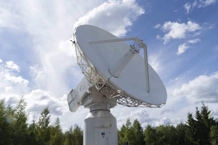
The cornerstone of satellite positioning in Finland is the Metsähovi Geodetic Research Station
In Finland, reliable geospatial data and positioning are based on the Metsähovi Geodetic Research Station in Kirkkonummi, which is managed by the National Land Survey of Finland. With the help of observations made at Metsähovi, the NLS ensures that the positioning services needed by society remain functional.
For flawless positioning, satellites orbiting the Earth require observations provided by VLBI radio telescopes around the globe. In Finland, they are provided by a radio telescope located at Metsähovi.
The UN’s goal of safeguarding the observations required by radio telescopes from other signals is timely, as at the current rate, the increasing number of signals will seriously complicate positioning in the coming years. The aim is to get the member states’ backing for the safeguarding of the VLBI spectrum at the next World Radiocommunication Conference (WRC) organised by the UN’s International Telecommunication Union (ITU) in 2027, where the member states can update the rules governing the sector.
Morel information
UN report on safeguarding VLBI radio frequencies
Professor Hannu Koivula, Finnish Geospatial Research Institute of the National Land Survey of Finland, +358 29 531 4787
firstname.lastname@nls.fi